Physical geography · Atlas of Telangana
Hill ranges & high points of Telangana
Ranges, high points and the Nallamala
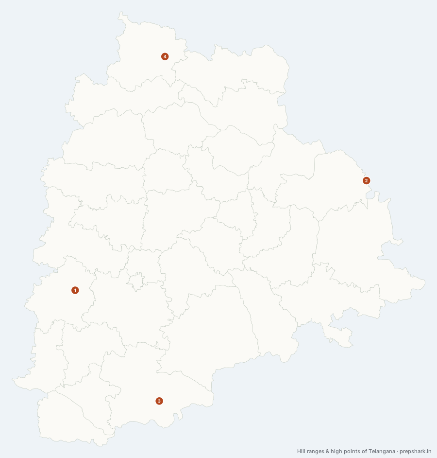
Numbered as on the map
The 4 on the map
1. Ananthagiri Hills
Vikarabad
Known forWhere the Musi rises — Hyderabad’s own river.
A wooded rise on the high western rim of the plateau, ninety kilometres west of Hyderabad, and the source of the Musi. That single fact is why a modest set of hills matters: everything Hyderabad drinks, floods with and pollutes starts here, and the city’s two reservoirs were built to catch what comes down.
SettingPlateau rim · Dry deciduous forest · Musi headwaters
For the examThe Musi rises here and joins the Krishna at Wazirabad in Nalgonda, which is what connects Hyderabad’s water to Nalgonda’s.
2. Doli Gutta
Mulugu
Known forThe highest point in Telangana, 965 m, on the Chhattisgarh line.
The highest point in Telangana at 965 m, on the ridge where Mulugu district meets Bijapur district in Chhattisgarh. It is not a mountain in any dramatic sense — it is the highest swell of the forested country the Godavari’s left-bank tributaries come down out of — and its importance is entirely that nothing in the state is higher.
SettingEastern forest ridge · Godavari left-bank catchment · Interstate summit
For the examIt became the highest point only in 2014. Until the state was divided, the Chintoor and Vararamachandrapuram mandals of erstwhile Khammam belonged to Telangana and Pedda Konda in them rose to 1,360 m; those mandals went to Andhra Pradesh, and Doli Gutta inherited the title.
3. Nallamala Hills
Nagarkurnool
Known forThe Eastern Ghats in Telangana, and the state’s largest forest.
The only part of the Eastern Ghats that reaches Telangana, running down the south of the state to the Krishna and continuing far into Andhra Pradesh. It is quartzite rather than the granite and basalt the rest of the state stands on, which is why it never became farmland and why the state’s largest block of forest is on it.
SettingEastern Ghats quartzite · Dry deciduous forest · Krishna gorge · Chenchu homeland
For the examThe Nallamala is the only hill system in Telangana belonging to the Eastern Ghats; everything else in the state is plateau surface. Amrabad Tiger Reserve covers its Telangana share.
4. Satmala Hills
Adilabad
Known forThe northern range, between the Penganga and the Godavari.
The one named range in the north of the state, running east–west across Adilabad above the Godavari. It is the southern edge of the hill country that separates the Penganga’s catchment from the Godavari’s, and it is the reason Adilabad is the only district in Telangana that does not feel like plateau farmland.
SettingNorthern hill country · Teak forest · Penganga–Godavari divide
Keep going